

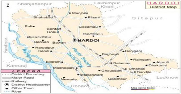
Hardoi district is a district of Lucknow Division of Uttar Pradesh. It lies between 26'-53" to 27"-31'North Latitude and 79'-41" to 80'-46" East Longitude. Its north border touches Shahjahanpur & Lakhimpur Kheri Districts. Lucknow and Unnao are Situated at south border, West Borders touches Kanpur & Farrukhabad and on eastern border Gomti river separates the district from Sitapur.
According to general conventions hardoi district is related with "HIRNAKASHYAP" its present name hardoi is a distorted version of its earlier name "HARIDROHI ". In view of some people this district was colonized by Hardevbaksh and just because of this reason there is an old locality Hardevganj exists in the city. Mallawa, Bilgram, Pihani, Shahabad, Sandila & Ruiyaa are the places of historical significance. According to some historians Mallawa was colonized by Buddhists while some believed that Sayyed Salar Masood Gazi came here. Earlier this area Mallawa was district headquarter. The ancient name of Bilgram is "SRINAGAR" its present name Bilgram was given by some associates of .Mahmood Gajnavi.Pihani is derived by persian word Pinhani (place of shelter), it is believed that king of Moughal dynasty Humayun took shelter in the forest of Pihani when he was defeated by Shershah Suri. Pihani is also related with the minister Sadarejahan of Emperor Akbar. His tomb and paintings are still here.According to the view of some people, Sandila was colonized by Rishi Sandilya. Sandila is also famous for old buildings,mosque & barakhamba.
| S.N. | Farming System / Enterprise |
|---|---|
| 1 | Paddy - wheat, Maize - Wheat, Maize-potato, rice - mustard, Maize-potato-vegetable, groundnut-barley- vegetable are major cropping sequence. |
| 2 | Area under sugarcane increased. |
| 3 | Due to high level of sodicity in AES IV crop rotation with lentil, gram, onion and maize are not followed. |
| 4 | Bajara-wheat is associated with AES II and III and groundnut is sown as a important kharif crop but irregular rainfall and irrigation problems area under groundnut cultivation is decreasing day by day. |
| 5 | The resource rich farmers keep graded buffalo but poor people keep desi buffaloes and 5-6 goats. |
| 6 | Fruit and agro-forestry based farming systems are adopted largely by resource rich farmers and river bed farming system are operated by poor and landless farmers. |
| 7 | Garlic, onion, vegetable pea for green pods and watermelon, cucumber and cucurbits are the component of farming system which provides highest net returns. |
| S.N. | Agro-Climatic Zone | Characteristics |
|---|---|---|
| 1 | Central mid plain zone-V | Major crop production zone of U.P. Cropping intensity - 142% Climate-Moist, sub-humid and dry sub-humid Rainfall - 1211 - 1470mm Most of the area occurs in middle of Ganga and Yamuna river Major crops-Wheat, rice, sugarcane, maize, potato, vegetable and pulses etc Average land holding 0.90 ha. Total NPK consumption (52.11, 25.43 and 2.62 Kg/ha) |
| S.N. | Agro-Climatic Zone | Characteristics |
|---|---|---|
| 1 | AES-I | Loamy soil, silty loam soil and loamy sand soil, slightly high pH, borewell, canal, irrigated area. Area comprises six blocks ie. Sandila, Bharawan, Benhdar, Kothawan, Kachhona and Ahirori. Major crops Wheat and other horticultural crops. Dairy is the major subsidiary occupation. |
| S.N. | Agro-Climatic Zone | Characteristics |
|---|---|---|
| 2 | AES-II | Loamy, sandy loam and silty loam, normal pH is existing. This AES is mainly irrigated through borewell tubewell and canal. Area comprises six blocks ie. Bharkhani, Shahabad, Todarpur, Pihani, Hariyawan and Tadiyawan. |
| S.N. | Agro-Climatic Zone | Characteristics |
|---|---|---|
| 3 | AES-III | Loamy and loamy sand soil is dominated soil, irrigation facility is poor, mainly rainfed area and some area are covered through borewell and tubewell. Area comprising in this AES seven blocks ie. Bawan, Harpalpur, Sandi, Sursa, Bilgram, Madhoganj and Mallawan. Main crops are maize, urd, moong, mustard, pea and gram. |
| S.N. | Soil Type | Characteristics | Area in (ha) |
|---|---|---|---|
| 1 | Sandy Loam | Light gray to light brownish gray, neutral to mildly, alkaline, fair water holding capacity and fertilizer responsive. | 103492 |
| 2 | Loam | Light gray to light greenish, sandy loam to loam calcareous, impregnate with big kankars. Good wateholding capacity and nitrogen responsive. | 95530 |
| 3 | Low Land and Clay Loam | Brownish gray to gray white, very strongly alkaline, water soluble salt pre-dominated, poor in organic matter and nitrogen & zinc water table. Fertilizer responsive only water reclamation. | 199022 |
| S.N. | Crop | Area (ha) | Production (Qtl) | Productivity (Qtl /ha) |
|---|---|---|---|---|
| 1 | Rice | 100227 | 2262123 | 22.57 |
| 2 | Wheat | 343069 | 1062320 | 39.96 |
| 3 | Maize | 39179 | 55447 | 14.15 |
| 4 | Jowar | 6474 | 6896 | 10.65 |
| 5 | Bajra | 4371 | 4818 | 11.02 |
| 6 | Barley | 1812 | 2487 | 13.73 |
| 7 | Urd | 26755 | 14861 | 5.55 |
| 8 | Mung | 263 | 114 | 4.33 |
| 9 | Ground Nut | 7300 | 70010 | 9.59 |
| 10 | Arhar | 1721 | 11880 | 6.9 |
| 11 | Til | 25934 | 35270 | 1.36 |
| 12 | Sunflower | 159 | 3650 | 22.96 |
| 13 | Mustard | 12749 | 118680 | 9.31 |
| 14 | Sugarcane | 52069 | 14420020 | 508.84 |
| 15 | Potato | 11153 | 3068080 | 275.09 |
| 16 | Gram | 749 | 6370 | 8.51 |
| 17 | Pea | 1053 | 13710 | 13.02 |
| 18 | Lentil | 10596 | 113800 | 10.74 |
| 19 | Total Oilseed | 46157 | 227690 | 4.93 |
| 20 | Total Pulses | 41137 | 295510 | 7.18 |
| 21 | Total Cereals | 566294 | 14258580 | 25.7 |
| Horticulture | ||||
| 1 | Onion | 528 | ||
| 2 | Vegetable | 17049 | ||
| 3 | Mango | 6599 | 17810 | 2.69 |
| 4 | Guava | 341 | 3571 | 10.47 |
| 5 | Papaya | 3 | 66 | 22 |
| 6 | Garlic | 115 | 461 | 0.61 |
| 7 | Cucumber | 450 |
| Month | Rainfall (mm) | Temperature C | Relative Humidity (%) |
|---|---|---|---|
| April 2014 | 0.00 | Maximum : 36.70 Minimum : 27.50 |
58.50 |
| May 2014 | 4.76 | Maximum : 40.90 Minimum : 34.35 |
57.37 |
| June 2014 | 8.52 | Maximum : 42.73 Minimum : 33.12 |
55.38 |
| July 2014 | 109.32 | Maximum : 32.90 Minimum : 29.45 |
81.34 |
| August 2014 | 35.48 | Maximum : 32.16 Minimum : 27.90 |
88.24 |
| Sept. 2014 | 83.34 | Maximum : 34.83 Minimum : 27.29 |
89.18 |
| October 2014 | 21.66 | Maximum : 18.50 Minimum : 24.25 |
82.85 |
| November 2014/th> | 0.00 | Maximum : 28.56 Minimum : 18.50 |
81.20 |
| December 2014 | 9.38 | Maximum : 22.16 Minimum : 14.90 |
80.12 |
| January 2015 | 14.83 | Maximum : 18.05 Minimum : 6.78 |
74.75 |
| February 2015 | 6.40 | Maximum : 21.63 Minimum : 10.41 |
70.12 |
| March 2015 | 38.98 | Maximum : 27.58 Minimum : 14.46 |
66.76 |
| Category | Population | Production | Productivity |
|---|---|---|---|
| Cattle | |||
| Crossbred | 32982 | ||
| Indigenous | 540298 | ||
| Buffalo | 463374 | ||
| Sheep | |||
| Crossbred | |||
| Indigenous | |||
| Goats | 383281 | ||
| Pigs | 37684 | ||
| Crossbred | |||
| Indigenous | |||
| Rabbits | 246 | ||
| Poultry | |||
| Hens | |||
| Desi | |||
| Improved | |||
| Ducks | |||
| Turkey and Others | |||
| Fish | |||
| Marine | |||
| Inland | |||
| Prawn | |||
| Scampi | |||
| Shrimp |
| S.N. | Subject | Unit | period | Particular |
|---|---|---|---|---|
| 1 | Geographical Area | Sq. K.M. | 2011 | 5989 |
| Male | In thousand | 2011 | 2187 | |
| Female | 2011 | 1897 | ||
| Total | 2011 | 4084 | ||
| Rurals | 2011 | 3542 | ||
| Cities | 2011 | 542 | ||
| Schedule Caste | 2011 | 1271 | ||
| Schedule Trible | 2011 | 0.36 | ||
| 2 | Number of Litracy Person | |||
| Male | 2011 | 1371.69 | ||
| Female | 2011 | 845.14 | ||
| Total | 2011 | 2216.83 | ||
| Number of below Poverty Family | ||||
| Rurals | 2002 | 352.99 | ||
| Cities | 2002 | 4.18 | ||
| Total | 2002 | 357.17 | ||
| 3 | Number of Election Areas | Number | ||
| Parliament | 2012-13 | 2 | ||
| Legeslative Assembly | 2012-13 | 8 | ||
| 4 | No. of Tehsils | 2012-13 | 5 | |
| 5 | No. of Blocks | 2012-13 | 19 | |
| 6 | No. of Nyay Panchayat | 2012-13 | 191 | |
| 7 | No. of Gram Panchayat | 2012-13 | 1101 | |
| 8 | Number of Villages | 2012-13 | ||
| Number of Established Villages | 2012-13 | 1905 | ||
| Number of un Established villages | 2012-13 | 165 | ||
| Total villages | 2070 | |||
| 9 | City & City organization | 2012-13 | 0 | |
| 10 | Nagar Nigam | 2012-13 | 7 | |
| 11 | Nagar Palika Parishad | 2012-13 | 0 | |
| 12 | Cantoomen Area | 2012-13 | 5 | |
| 13 | Nagar Panchayat | 2012-13 | 0 | |
| 14 | Senses Town | 2012-13 | 5 | |
| 15 | Police Station | |||
| Rural | 2012-13 | 10 | ||
| Cities | 2012-13 | 13 | ||
| 16 | Bus Station / Bus Stop | 2012-13 | 83 | |
| 17 | Railway Station (with Halt) | 2012-13 | 25 | |
| 18 | Lenth of Raily Line | |||
| Broad Gaze | Km. | 169 | ||
| Meter Gaze | 0 | |||
| 19 | Post Office | |||
| Cities | Number | 29 | ||
| Rural | Number | 304 | ||
| 20 | Telegraph Office | |||
| 21 | Telephone Users | Number | 8557 | |
| 22 | Corporate Banks | |||
| Nationalise Bank Branches | Number | 125 | ||
| Other Banks | Number | 4 | ||
| 23 | Rural Bank Branches | Number | 62 | |
| 24 | Cooperatve Bank Branches | Number | 20 | |
| 25 | Cooperatve Agriculture & Rural Development Bank Branches | Number | 7 | |
| 26 | Cheap grains sale merchant | |||
| Rural | Number | 1331 | ||
| Cities | Number | 161 | ||
| 27 | Bio Gas Instrument | Number | 8341 | |
| 28 | Cold Storages | Number | 24 | |
| 29 | Agriculture | |||
| Actual Sown Area | in ha | 433250 | ||
| More than one time sown area | in ha | 237359 | ||
| Pure irrigated area | in ha | 385284 | ||
| Total irrigated area | in ha | 553244 | ||
| 29 | Agriculture Production | |||
| Food Grains | in Mt. | 1628688 | ||
| Sugarcane | in Mt. | 1834293 | ||
| Oilseed | in Mt. | 227690 | ||
| Potato | in Mt. | 3068080 | ||
| 30 | Climate | |||
| 31 | Rain | |||
| General | m.m. | 941 | ||
| Actual | m.m. | 758.7 | ||
| 32 | Temperature | |||
| Highest | Centigrate | 43 | ||
| Lowest | Centigrate | 2.6 | ||
| 33 | ||||
| Length of Canals | 2012-13 | 1548 | ||
| Government Tubewells | 2012-13 | 511 | ||
| Private Tubewells and Pump Sets | 2012-13 | 91125 | ||
| 34 | Livestocks | |||
| Total Livestock | 2007 | 1490625 | ||
| Veterinary Hospitals | 2012-13 | 47 | ||
| Veterinary Hospitals - D Category | 2012-13 | 2 | ||
| Livestocks Service Center | 2012-13 | 61 | ||
| Artificial Insemination Center | 2012-13 | 68 | ||
| Number of livestock per 100 ha area | 2007 | 248.9 | ||
| Number of livestock per 1000 population | 2007 | 390.5 | ||
| Number of milch animals per 100 population | 2007 | 10.50 | ||
| Number of poultry birds per 1000 population | 2007 | 53.20 | ||
| 35 | Cooperatives | |||
| Begening Agriculture Loan Cooperatives | 2012-13 | 199 | ||
| No. of Cooperative members | 2012-13 | 336 | ||
| 36 | Industries | |||
| Registered Workshop under 1948 Act | 2009-10 | 71 | ||
| 37 | Small Scale Industries | |||
| Number of Small Scale Industries | 2012-13 | 75 | ||
| Number of Workers | 2012-13 | 1875 | ||
| 38 | Education | |||
| Primary Schools | 2012-13 | 3952 | ||
| Higher Secondary Schools | 2012-13 | 1314 | ||
| Intermediate College | 2012-13 | 463 | ||
| Alternative Education Center | 2012-13 | 128 | ||
| Graduate College | 2012-13 | 28 | ||
| Post Graduate College | 2012-13 | 3 | ||
| Universities | 2012-13 | 0 | ||
| Industrial Training Institutes | 2012-13 | 4 | ||
| Polytechnique | 2012-13 | 1 | ||
| Teachers Training Institute | 2012-13 | 1 | ||
| Engineering Colleges | 2012-13 | 0 | ||
| Medical Colleges | 2012-13 | 0 | ||
| 39 | Human Medico | |||
| 40 | Hospitals and Dispenseries | |||
| Alopathic | 2012-13 | 10 | ||
| Aauryadic | 2012-13 | 46 | ||
| Homeopathic | 2012-13 | 36 | ||
| Unani | 2012-13 | 10 | ||
| Community Health Center | 2012-13 | 14 | ||
| Primary Health Center | 2012-13 | 77 | ||
| 41 | Land Holding | |||
| Total Number of Land holding | 2005-06 | 601546 | ||
| Percentage of Small and marginal land holding | 2005-06 | 93.6 | ||
| Percentage of area under small and marginal size of land holding | 2005-06 | 71.4 | ||
| Average size of land holding | 2005-06 | 0.80 |